Tina Russell · 25 September 2026
Atmospheric Modeling Techniques Reshaping Planning Strategies for Expansive Open-Air Cultural Events
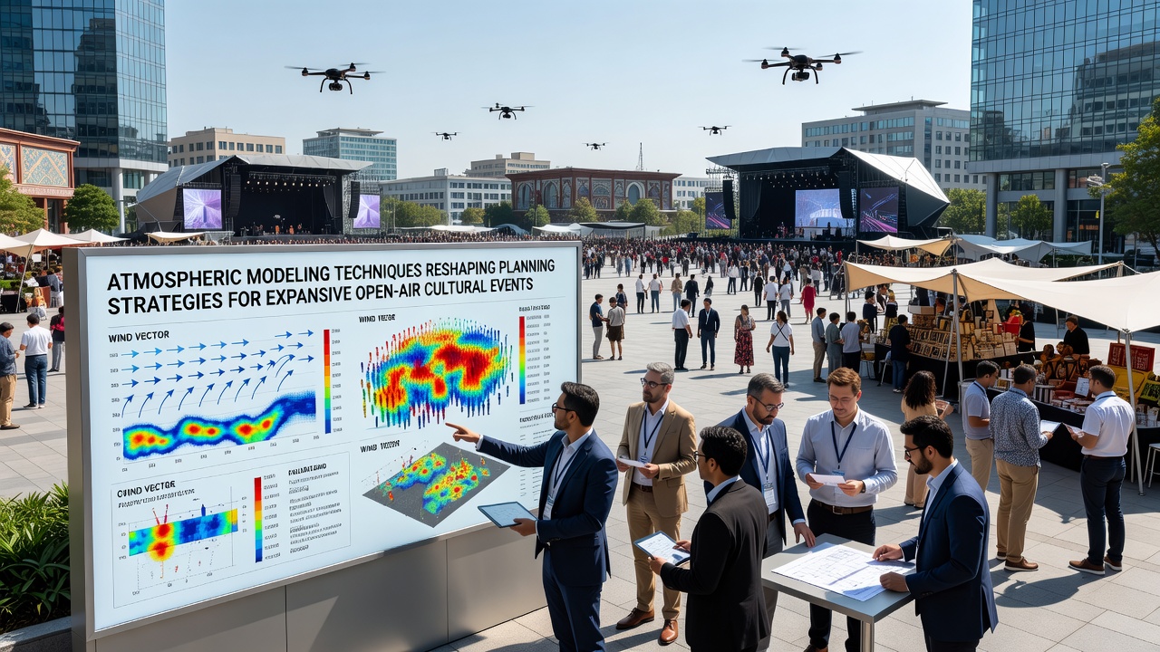
Atmospheric modeling applies computational simulations to predict wind flows, temperature gradients, precipitation patterns, and air quality across large outdoor venues, and these tools now guide decisions on site layout, crowd movement, and safety protocols for expansive cultural events. Organizers integrate high-resolution numerical models with real-time sensor data to forecast how local weather interacts with terrain and structures, which allows adjustments before construction begins on stages, barriers, and access routes.
Core Techniques Behind Modern Atmospheric Models
Researchers rely on computational fluid dynamics combined with mesoscale weather prediction systems to simulate microclimates at event scales, while machine learning refines these outputs by incorporating historical data from past gatherings. Data from these models reveal how hills or buildings create wind tunnels that concentrate heat or disperse particulates, and planners use the results to position food vendors, medical stations, and emergency exits accordingly. Studies conducted across multiple continents show that coupling ensemble forecasting with on-site anemometers improves accuracy for events spanning several square kilometers.
Integration into Event Planning Workflows
Event teams now embed atmospheric outputs directly into geographic information systems during the initial design phase, which shifts decisions on fencing orientation and drainage systems away from static rules toward dynamic simulations. When models indicate potential stagnation zones during peak attendance hours, coordinators adjust performance schedules or add temporary ventilation structures to maintain safe conditions. This approach has been applied in preparations for events scheduled through September 2026, where updated projections account for seasonal shifts in prevailing winds and humidity levels.
One case involved a multi-day music festival in a valley setting where initial site plans placed main stages in a low-lying area prone to fog accumulation. Revised simulations prompted relocation of secondary stages uphill and reconfiguration of pedestrian pathways to reduce exposure during temperature inversions. Similar adjustments appear in reports from North American and European organizers who cross-reference model results with local regulatory requirements for air quality and noise propagation.
Data Sources and Validation Methods
Model validation draws from networks maintained by the National Oceanic and Atmospheric Administration in the United States alongside the European Centre for Medium-Range Weather Forecasts, which supply boundary conditions for finer-scale event simulations. ECMWF datasets supply global atmospheric profiles that regional teams downscale for specific venues, and field measurements collected during smaller test events calibrate the parameters. Accuracy improves when organizers deploy temporary lidar stations and weather balloons to capture vertical profiles of wind and temperature on the actual site.

Applications for Safety and Environmental Compliance
Evacuation route planning benefits directly from wind vector maps that identify how smoke or airborne hazards would travel under different scenarios, and these maps inform placement of signage and assembly points. Air quality modules within the models track particulate matter from generators, cooking areas, and attendee vehicles, which supports compliance with emission thresholds set by agencies in Canada and Australia. When projections flag elevated ozone formation risks during afternoon hours, organizers limit vehicle access or shift heavy equipment operations to earlier periods.
Take one research team that compared outcomes at two comparable festivals held in consecutive years. The second event incorporated full atmospheric modeling from the outset, resulting in measurable reductions in localized heat stress incidents and faster clearance times during simulated emergency drills. Observers note that such iterative improvements stem from continuous data feeds rather than one-time assessments.
Emerging Trends Through 2026
By September 2026 several major open-air cultural events are scheduled to test next-generation hybrid models that merge satellite observations with ground-based IoT sensors in real time. These systems update forecasts every fifteen minutes and feed directly into mobile applications used by staff for on-the-ground adjustments. Academic institutions in Asia and South America contribute regional parameterization schemes that address unique topographic challenges such as coastal breezes or high-altitude plateaus.
Conclusion
Atmospheric modeling has moved from supplementary analysis to core infrastructure in the planning of expansive open-air cultural events, reshaping how organizers address wind, temperature, and air quality variables. Continued refinement of these techniques relies on expanded sensor networks and cross-regional data sharing, which together support safer and more adaptive strategies for events planned well into the coming decade.